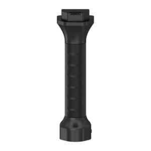
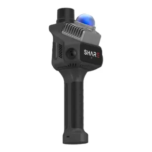

Explore the SHARE SLAM range of handheld LiDAR scanners designed for fast, accurate, and efficient 3D data capture. These portable mapping solutions allow professionals to scan indoor and outdoor environments while moving freely through the site, making them suitable for surveying, construction, architecture, renovation, forestry, facility management, and digital twin applications.
The SHARE SLAM series includes the compact SHARE SLAM S20 and the more advanced SHARE SLAM S100 models. Different configurations are available to support projects of varying sizes, complexity, and data-capture requirements.
For many renovation and interior documentation workflows, 3D scanning can replace most repetitive manual measurement work and make site capture faster, more complete, and easier to reuse. In practice, it is best viewed as a workflow improvement for renovation teams rather than a guarantee that every manual check can be eliminated on every project.
Commonly used tools include tape measures, laser distance meters, and 3D scanners. Tape measures and laser distance meters are still suitable for simple checks. For complex spaces, repeated verification, modelling, drawing preparation, or coordination between multiple teams, 3D scanning is generally more practical because it captures more spatial context in a single workflow.
Renovation measurements, 3D scanning
For many indoor renovation projects, a 3D scanner can replace a large amount of repetitive manual measuring and note-taking. Critical dimensions, concealed spaces, installation details, and tolerance-sensitive checks may still require targeted manual verification.
Manual measurements, Workflow limitations
Yes. 3D scanning is often useful when renovating old buildings because the original drawings may be missing, incomplete, or different from the actual on-site conditions. A scan helps teams document the existing situation and create a more reliable reference point before design, measurement, or documentation begins.
Old building renovation, Existing conditions
Interior designers can use 3D scanning to capture an entire space during a site visit. The point cloud or visual model can then be used as a reference during design preparation. This is especially useful for complex interiors, older buildings, and projects where faster quotation development is required.
Interior design, Site dimensions
Scan data can help clients and project teams understand a space more clearly than photos or handwritten notes alone. Point clouds, visual representations, and measurable spatial data can support design discussions, quotation reviews, change communication, and coordination between designers, contractors, and clients.
Client communication, Spatial data
They can. A scanner records visible conditions, so furniture, partitions, people, and clutter can cause local obstructions. Better route planning, capturing the space from multiple angles, and targeted verification can reduce their impact.
Obstruction, Capture path
3D scanning can convert site conditions into verifiable and measurable spatial data. It is useful for documenting existing conditions, progress documentation, as-built documentation, coordination, and handover support.
Construction documentation, Site data
Yes. Scan results can support as-built documentation by providing a digital record of the actual site conditions. They can be used to verify measurements, compare progress, prepare drawings and handover documents, and discuss issues. However, final deliverables should still be checked against the applicable project standards.
As-built documentation, Handover documents
Point cloud data can be used to verify measurements, assess spatial context, provide a reference for models, create CAD drawings, prepare BIM workflows, support coordination, and produce project documentation.
Point cloud, CAD
LiDAR scan data is usually processed into point clouds first. Software can then help generate or support CAD drawings. In practice, teams still need to review and edit the drawings according to drafting standards and project requirements.
DWG, Drawing output
Yes. Scan data is often used as a reference for CAD drafting, SketchUp modelling, BIM preparation, measurement verification, and coordination. It should be viewed as a reliable spatial reference and workflow input rather than a fully automated replacement for professional drafting or modelling work.
CAD, BIM, SketchUp
Teams should evaluate workflow suitability rather than looking only at specifications. Practical factors include capture speed, ease of indoor use, output formats, software processing, team onboarding, and the requirements of later CAD, BIM, or documentation workflows.
Scanner selection, Workflow suitability
The SHARE SLAM S20 is commonly used for handheld indoor capture, renovation measurements, interior spaces, and compact site documentation. The SHARE SLAM S100 is generally used for larger spaces, more complex sites, outdoor capture, mixed indoor and outdoor capture, and professional mobile mapping workflows.
SHARE SLAM S20, SHARE SLAM S100
SHARE Capture supports on-site capture, device connectivity, and fieldwork. SHARE PointClouds Studio supports point cloud processing workflows, data analysis, 3DGS model generation, CAD drawing preparation, and documentation.
SHARE Capture, SHARE PointClouds Studio
SHARE Capture and SHARE PointClouds Studio are available to SHARE3DCAM users. Feature availability, supported devices, regional access, and release timing may vary by product version. Teams should therefore verify the latest software information before starting a project.
Software access, Project implementation
We’ll get back to you within one business day.
By sending this quote request, you agree to our Privacy Policy.
We’ll get back to you within one business day.
By sending this quote request, you agree to our Privacy Policy.
We’ll get back to you within one business day.
By sending this quote request, you agree to our Privacy Policy.