Professional handheld 3D LiDAR scanner for mapping and surveying
Scans up to 200,000 points per second for detailed point clouds
Integrated RTK-GNSS positioning for centimeter-accurate measurements
Dual 1-inch CMOS cameras with mechanical shutter for accurate color reproduction
Suitable for BIM, CAD, infrastructure inspection, and 3D modeling
About the product:
Professional handheld 3D LiDAR scanner for mapping and surveying
Scans up to 200,000 points per second for detailed point clouds
Integrated RTK-GNSS positioning for centimeter-accurate measurements
Dual 1-inch CMOS cameras with mechanical shutter for accurate color reproduction
Suitable for BIM, CAD, infrastructure inspection, and 3D modeling
✔ Customer rating: 10 / 10 ✔ Free shipping on orders over €99 ✔ Standard EU warranty included ✔ Secure payments with SSL encryption ✔ Personal customer service ✔ Fast & reliable delivery ✔ Multiple payment methods available ✔ ISO 9001 certified
Pay with
Shipped by
SHARE3DCAM C1 Pro (S20 RTK) 3D LiDAR Scanner – 40m to 70m
Request a Quote
✓ In stock – available immediatelyThis product is available directly from stock.
6+ years experience in drone industry
Ships within 24 hours from EU warehouse
2-Year limited warranty
No import duties
Best price guarantee
Free shipping above €100
High customer satisfaction
6+ years experience in drone industry
Ships within 24 hours from EU warehouse
2-Year limited warranty
No import duties
Best price guarantee
Free shipping above €100
High customer satisfaction
SHARE3DCAM C1 Pro (S20 RTK): High-Precision Handheld LiDAR Scanner for Surveying and 3D Reality Capture
Introduction
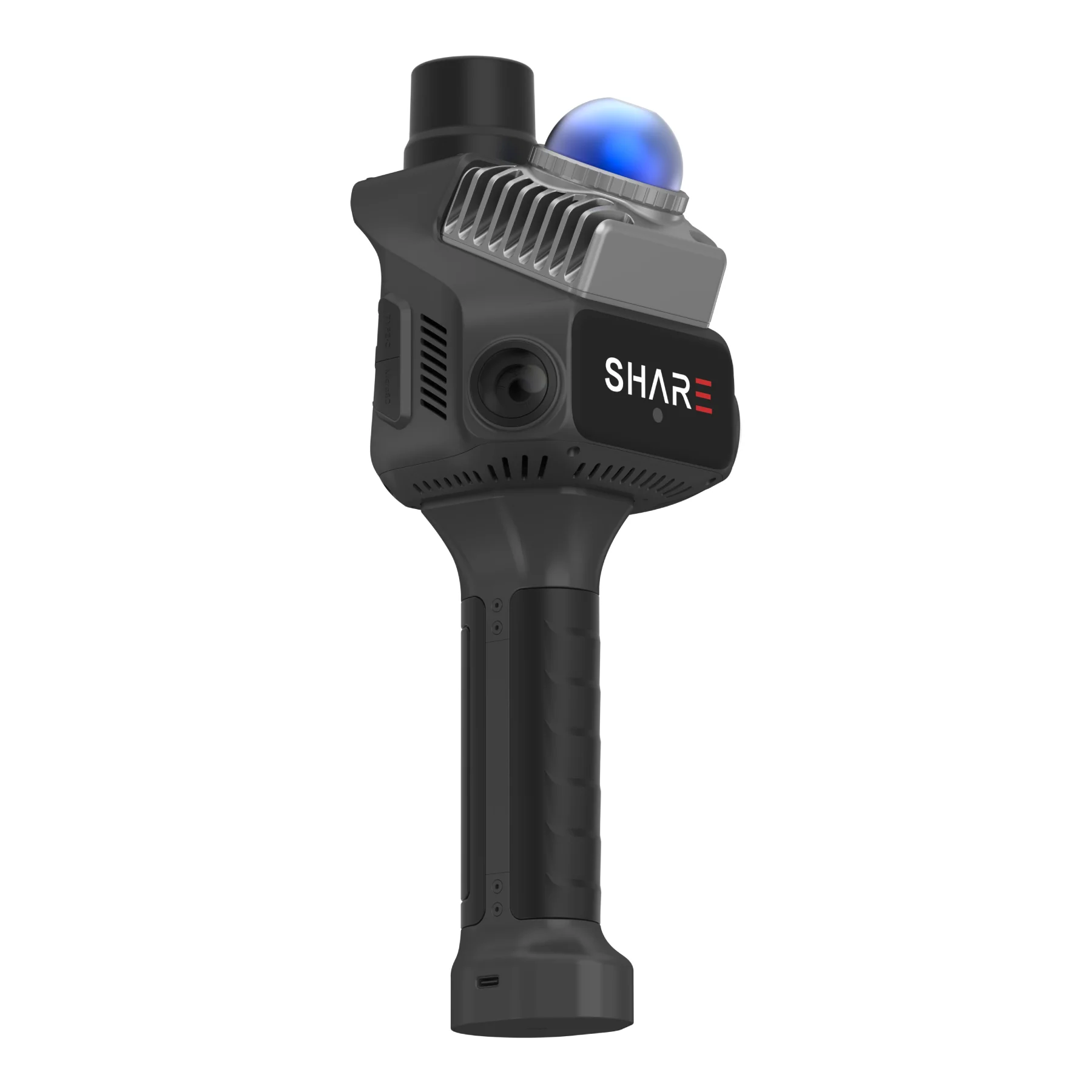
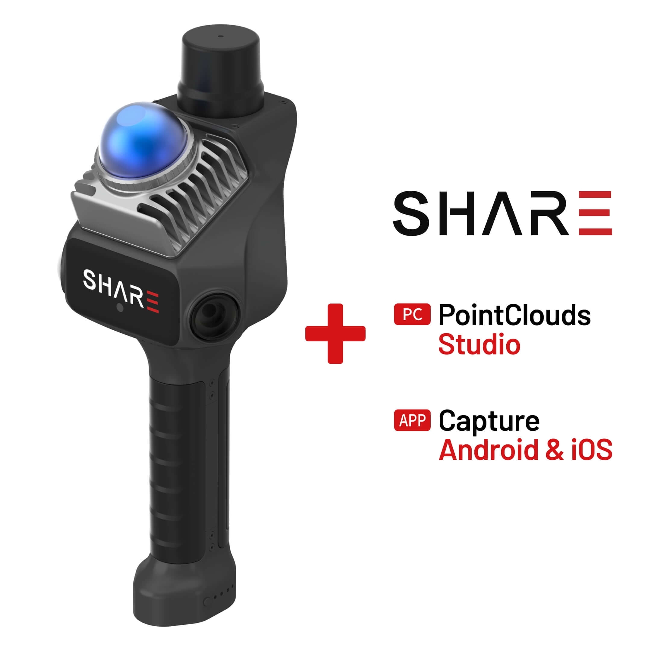
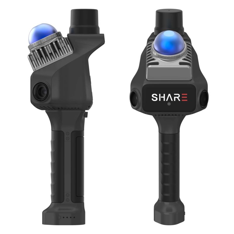
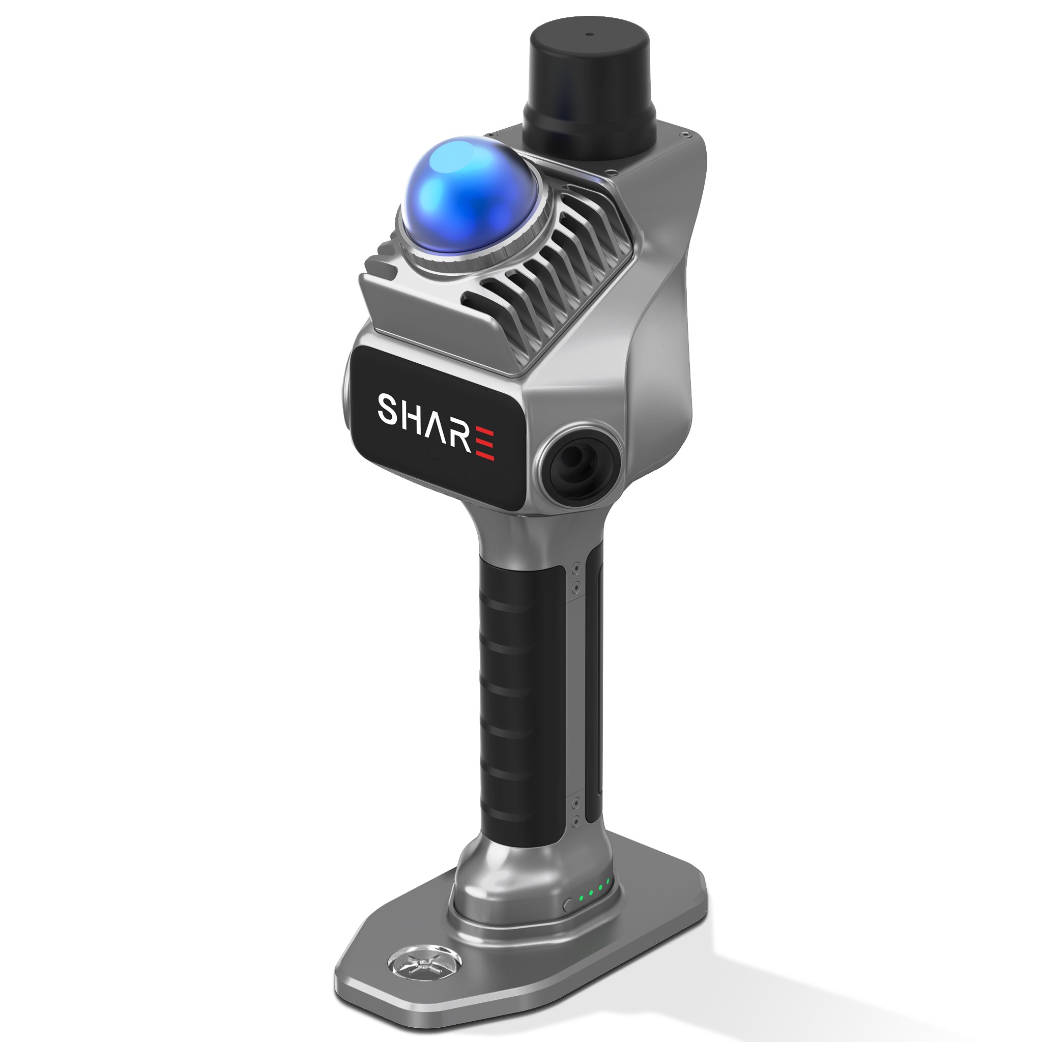
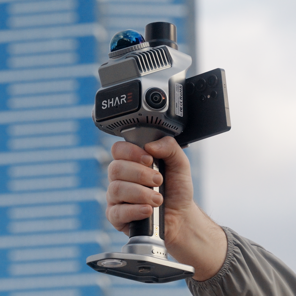
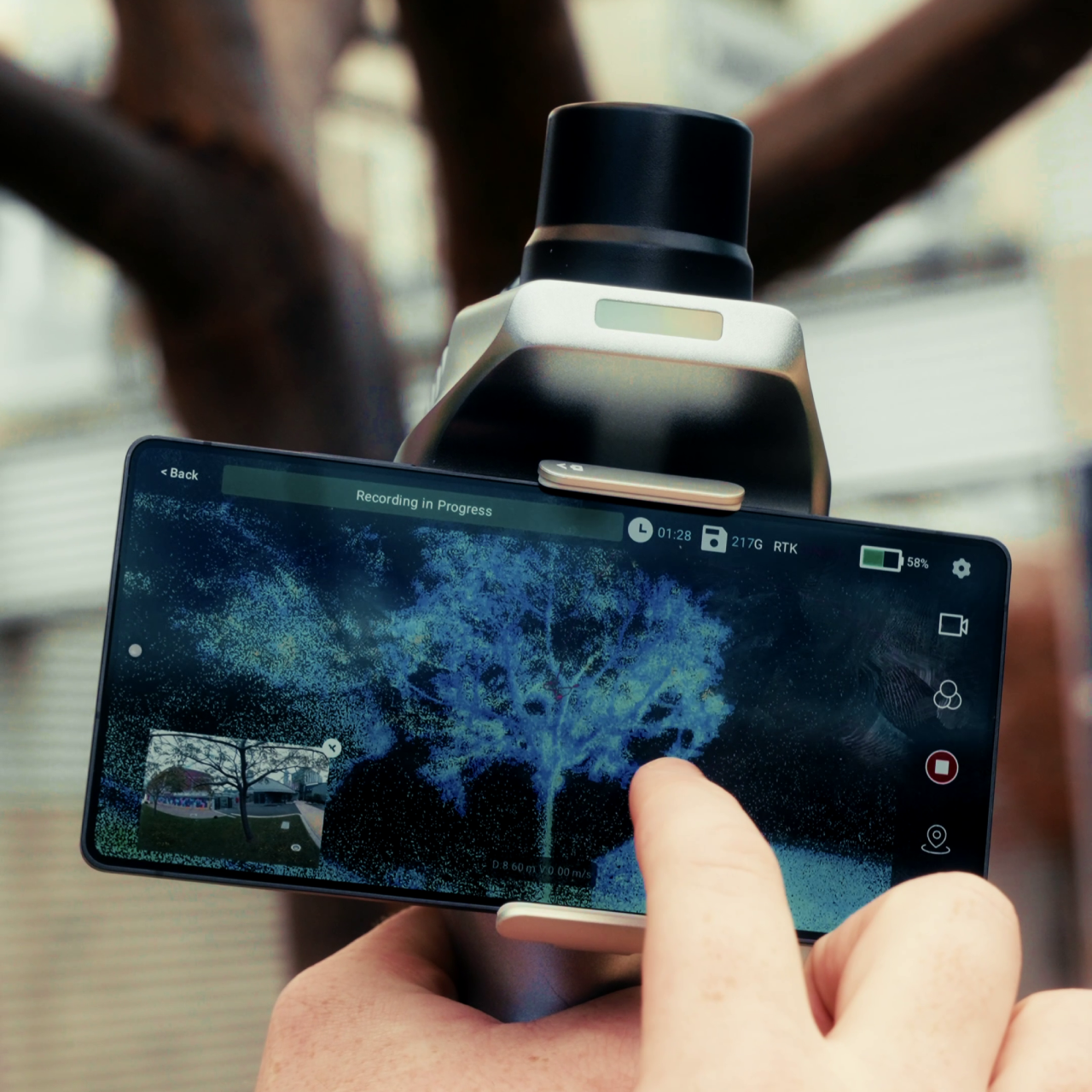
The SHARE3DCAM C1 Pro is a professional handheld 3D LiDAR scanner designed for surveying, mapping, construction documentation, digital twins, and other applications where accurate spatial data is required in the field. The scanner combines high-quality inertial measurement, survey-grade SLAM algorithms, dual one-inch cameras, mechanical shutters, and integrated RTK positioning in a compact handheld system. The LiDAR system captures up to 200,000 points per second, while the dual 16 MP cameras provide detailed color information for realistic point cloud visualization. Integrated RTK positioning provides centimeter-level positioning accuracy for outdoor scanning without requiring a separate external positioning system. The C1 Pro is also designed for continuous scanning through complex spaces, including narrow passages, structures, and indoor-to-outdoor transitions. With approximately 150 minutes of battery life, 256 GB of expandable storage, and an operating temperature range of -20°C to 50°C, it provides a practical mobile platform for professional spatial data collection.
Survey-Grade LiDAR and High-Precision Spatial Capture
The C1 Pro combines LiDAR sensing, inertial measurement, and SLAM positioning to create detailed three-dimensional representations while the operator moves through the environment.
200,000 points per second: The LiDAR system captures approximately 200,000 points per second at a typical point cloud frequency of 10 Hz. This provides dense spatial information for walls, terrain, structures, equipment, and other scanned surfaces.
70 m maximum range: The scanner measures from 0.1 to 40 m at 10% reflectivity and up to 70 m at 80% reflectivity. This allows the same handheld system to capture both nearby interior details and larger outdoor features.
Centimeter-level accuracy: According to SHARE3DCAM specifications, the C1 Pro achieves relative accuracy better than 1 cm and absolute accuracy better than 5 cm. Point cloud thickness remains within 1 cm, providing accurate visualization and reliable measurement workflows.
Survey-grade SLAM: The integrated SLAM algorithm supports continuous mapping in a wide range of environments and generates point clouds in real time. Accurate inertial sensing helps maintain trajectory stability through narrow passages, complex structures, and indoor-to-outdoor transitions.
Dual One-Inch Cameras for Detailed Colorized Point Clouds
The C1 Pro combines LiDAR measurements with high-resolution imaging, allowing captured point clouds to contain detailed color information rather than geometry alone.
Dual 16 MP cameras: Two one-inch CMOS image sensors provide 16 MP effective pixels per camera with a pixel size of 2.4 μm. The larger sensors capture detailed imagery that improves the visual quality of colorized point clouds.
Mechanical shutter: The cameras use mechanical and electronic shutter modes, with the mechanical shutter helping to reduce rolling-shutter distortion during movement. This is particularly useful when the scanner is carried through a site during continuous data capture.
Spatial image synchronization: Camera exposure can be synchronized with camera POS information, helping align captured imagery with the scanner’s spatial position. This improves consistency between visual information and the corresponding LiDAR data.
Wide scene coverage: The camera system provides broad visual coverage around the scanner, capturing color information across walls, structures, terrain, and other surfaces while the LiDAR system records their three-dimensional position.
Integrated RTK and Portable Field Design
The C1 Pro is designed to reduce the amount of additional positioning equipment required for outdoor scanning while remaining compact enough for mobile field operations.
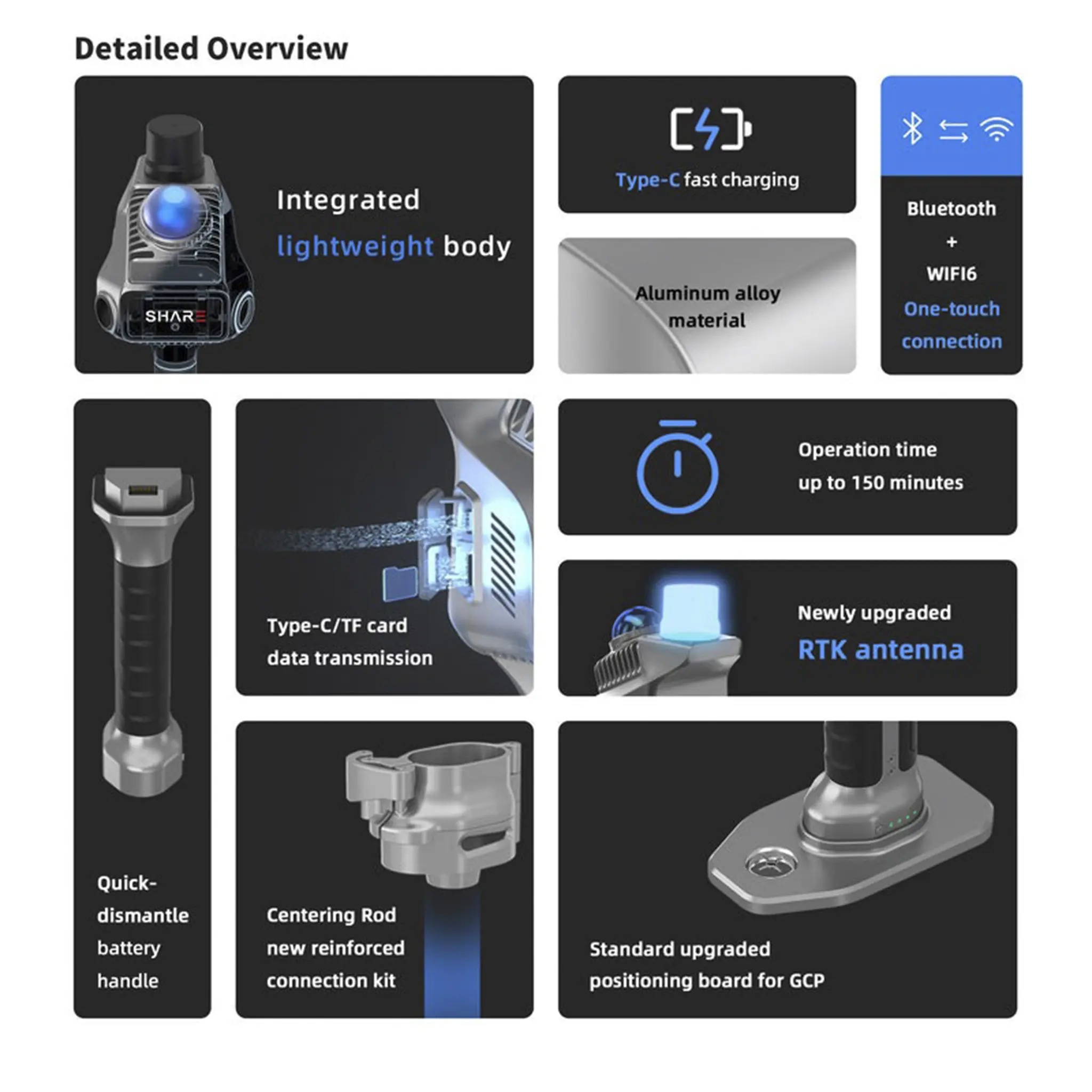
Built-in RTK: Integrated RTK positioning supports multi-constellation, multi-frequency GNSS positioning. The system supports seven satellite constellations and 24 frequency bands for efficient outdoor data collection and coordinate output.
RTK accuracy: RTK positioning accuracy is 0.8 cm + 1 ppm horizontally and 1.5 cm + 1 ppm vertically. This provides a direct positioning reference for applications where scanned data needs to be linked to a geographic coordinate system.
Lightweight construction: According to SHARE3DCAM specifications, the scanner weighs approximately 1079 g. Its dimensions of 110.5 × 140 × 313.3 mm provide a compact form factor for handheld scanning on construction sites, surveying areas, and indoor environments.
150-minute battery life: The 45.36 Wh, 3150 mAh battery provides approximately 150 minutes of operation. USB-C PD 30 W fast charging provides a practical charging solution for mobile field teams.
Field-ready operation: The C1 Pro is suitable for operation from -20°C to 50°C and storage from -20°C to 60°C. Its integrated design reduces the need to mount separate positioning hardware before beginning an outdoor scan.
Open Workflow, Storage, and Professional Data Processing
The C1 Pro is designed to fit into broader 3D data workflows, from field capture to point cloud processing and CAD and BIM applications.
256 GB storage: The scanner features 256 GB of internal storage with expansion capabilities. This provides substantial local capacity for capturing point clouds and imagery during extended field projects.
Wi-Fi 6 connectivity: Wi-Fi 6 supports 2.4 GHz and 5 GHz wireless communication with a specified range of up to 20 m. This enables wireless device communication and data transfer without relying entirely on physical connections.
USB-C interface: The Type-C interface supports 30 W PD fast charging and provides a direct connection for data workflows. A TF card interface is also available for expandable storage.
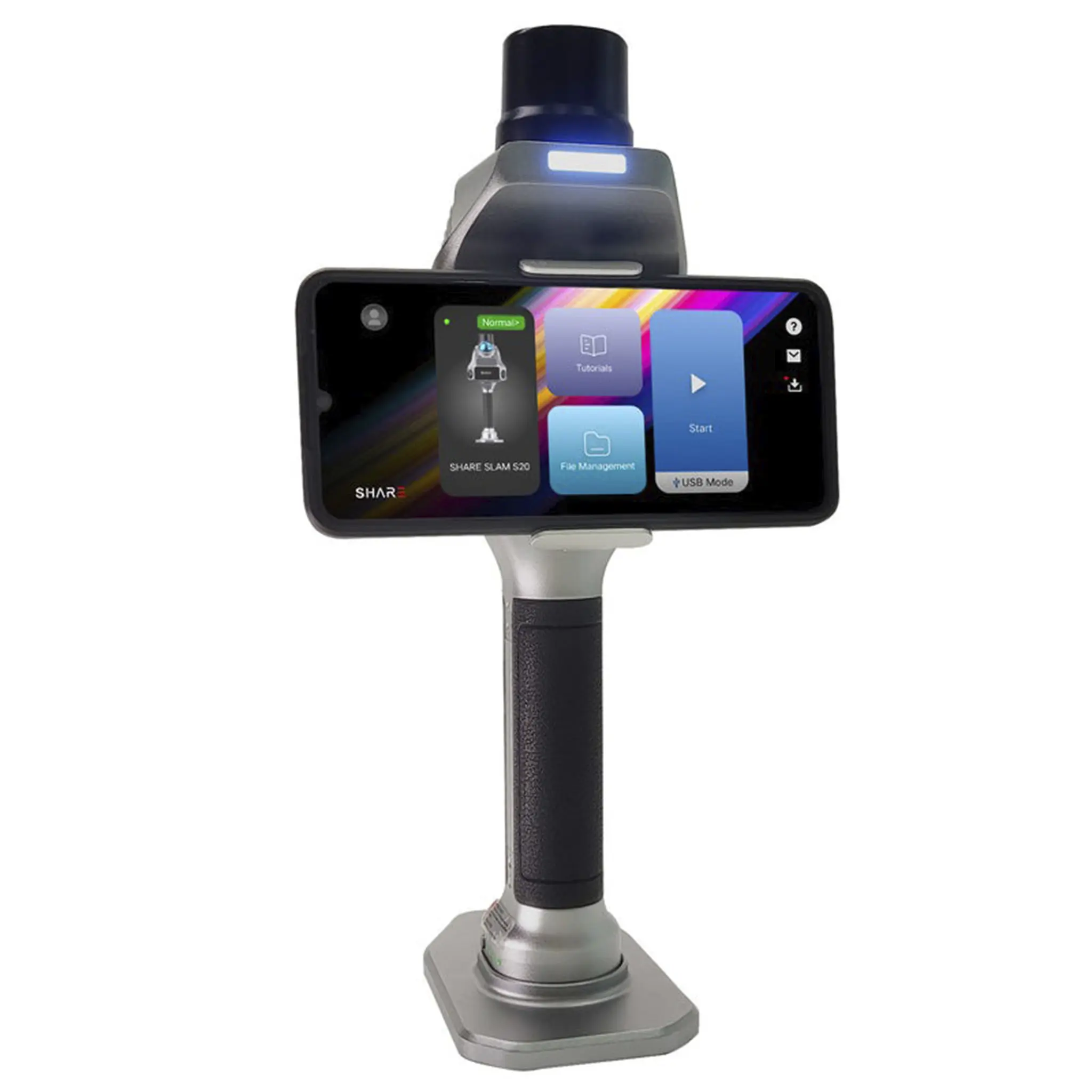
SHARE Capture: SHARE3DCAM’s SHARE Capture software is designed for on-site scanning, device connectivity, and project capture. It provides the field workflow layer for working with compatible SHARE3DCAM scanning hardware.
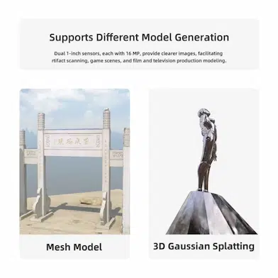
PointClouds Studio: SHARE PointClouds Studio provides post-processing capabilities, including point cloud processing, CAD drawing generation, 3D Gaussian Splatting model generation, measurement, and preparation for CAD and BIM workflows. This extends the C1 Pro from field capture into further spatial data production.
Real-World Applications
The C1 Pro is designed for professionals who require accurate three-dimensional data without relying on a large stationary scanning setup.
Construction and as-built surveying: Construction teams can scan buildings, structures, and work areas to create detailed spatial records for progress documentation and as-built reference. The combination of LiDAR, color imagery, and RTK positioning provides both visual context and measurable geometry.
Topographic surveying: Surveying professionals can capture roads, slopes, parks, narrow passages, and other local terrain features using a handheld workflow. The 70 m maximum measurement range and centimeter-level RTK positioning support efficient collection of spatial information across smaller survey areas.
Stockpile measurement: Mining, resource, and construction companies can scan the boundaries and surfaces of stockpiles to support volume calculations and inventory documentation. Dense point capture of approximately 200,000 points per second helps capture the shape of irregular stockpiles and their surroundings.
Forestry surveying: Forestry teams can capture tree trunks, canopies, forest floors, and undergrowth in three dimensions. The handheld form factor allows operators to move through areas that are difficult to document using larger surveying equipment.
Cultural heritage documentation: Surveyors and restoration specialists can continuously scan indoor and outdoor heritage structures to create detailed digital records. The combination of accurate geometry and colorized imagery supports digital archiving, restoration planning, and 3D visualization.
Why the SHARE3DCAM C1 Pro Is Essential
The SHARE3DCAM C1 Pro brings LiDAR, visual SLAM, high-resolution imaging, and RTK positioning together in a single portable surveying platform. The dual one-inch 16 MP cameras provide detailed color information, while the LiDAR system captures approximately 200,000 points per second for dense three-dimensional documentation. Integrated RTK provides centimeter-level positioning for outdoor projects, reducing the need for additional positioning equipment. Its weight of approximately 1.08 kg and 150-minute battery life make it practical for extended mobile scanning on construction sites, terrain, buildings, and heritage locations. With relative accuracy better than 1 cm and absolute accuracy better than 5 cm, the C1 Pro is suitable for professional spatial data collection where both portability and measurable results are important. Compatibility with SHARE3DCAM’s field capture and point cloud processing ecosystem also provides a complete workflow from field acquisition through CAD, BIM, and 3D visualization.
Product Model
SHARE3DCAM C1 PRO
Previous Model Name
SHARE SLAM S20 RTK
Product Type
3D LiDAR Scanner
Dimensions
110.5 × 140 × 313.3 mm
Weight
1079 g
Battery Capacity
45.36 Wh, 3150 mAh
Battery Life
Approximately 150 minutes
Charging
USB-C, PD 30 W fast charging
Operating Temperature
-20°C to +50°C
Storage Temperature
-20°C to +60°C
Internal Storage
256 GB
Storage Expansion
Supported
Wireless Connectivity
Wi-Fi 6
Wi-Fi Frequency
2.4 GHz / 5 GHz
Wi-Fi Range
Up to 20 m
Interfaces
TF Card, USB-C
LiDAR Point Rate
Approximately 200,000 points/second
Point Cloud Frequency
10 Hz typical
Measurement Range
0.1 to 40 m at 10% reflectivity
Measurement Range
0.1 to 70 m at 80% reflectivity
Point Cloud Thickness
Within 1 cm
Relative Accuracy
Better than 1 cm
Absolute Accuracy
Better than 5 cm
RTK
Built in
RTK Constellations
7 satellite constellations
RTK Frequency Bands
24 frequencies
RTK Horizontal Accuracy
0.8 cm + 1 ppm
RTK Vertical Accuracy
1.5 cm + 1 ppm
Camera Quantity
2
Camera Resolution
16 MP × 2
Camera Sensor
1 inch CMOS × 2
Pixel Size
2.4 μm
Camera Sensor Size
13.13 × 8.76 mm
Shutter
Mechanical shutter / electronic shutter
LiDAR Tilt Angle
25° toward ground
Processing
Real time / post processing
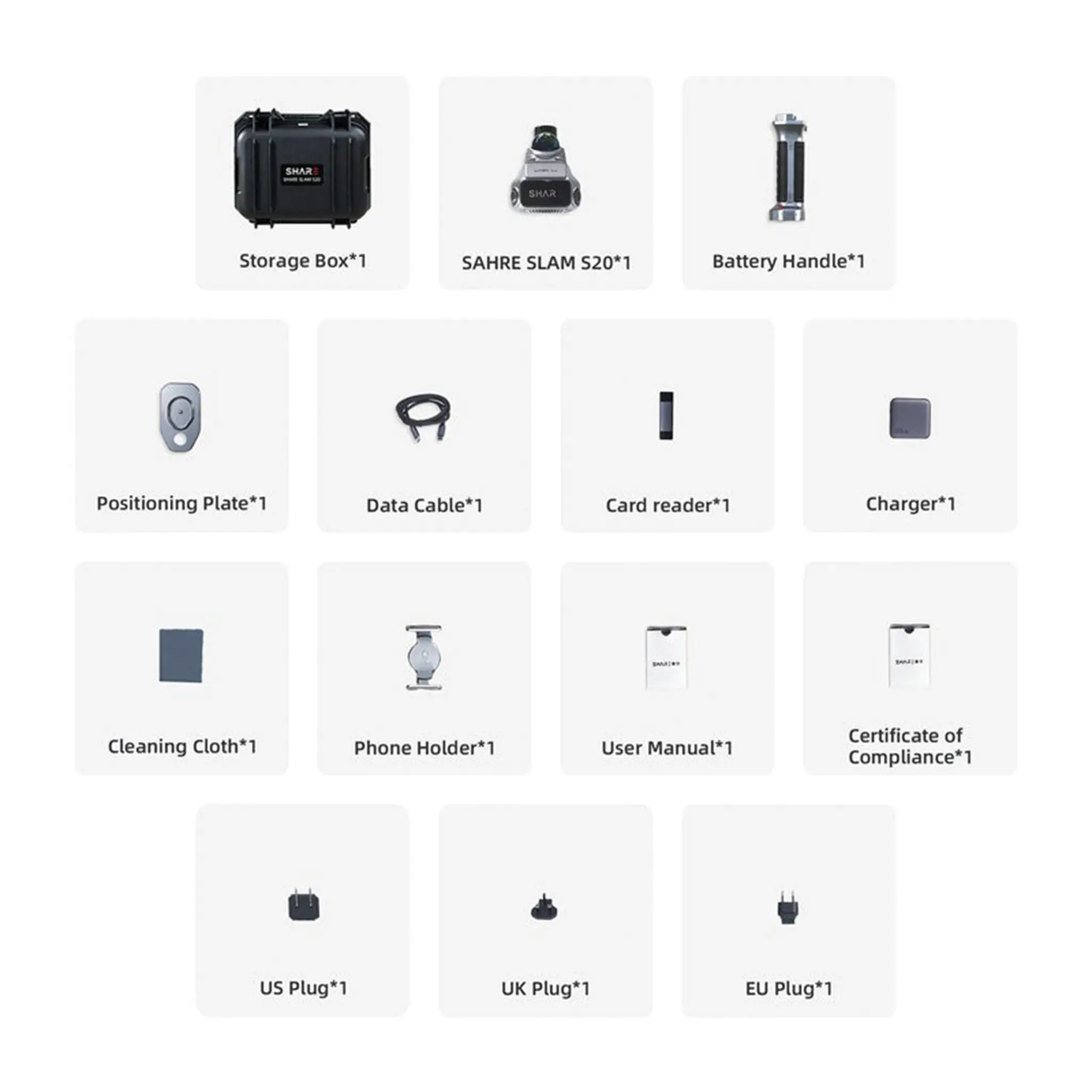
1 x SHARE3DCAM C1 Pro 3D LiDAR Scanner
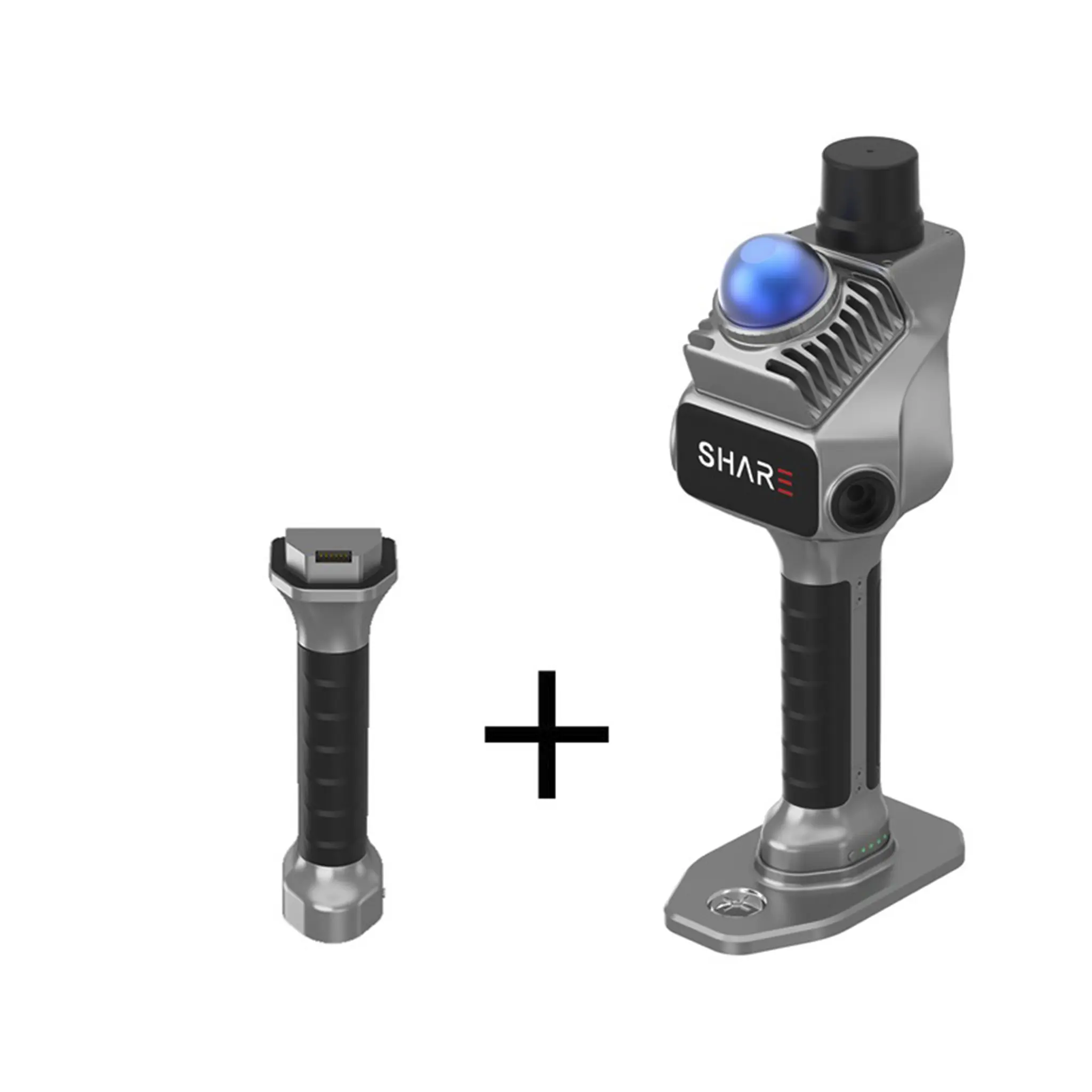
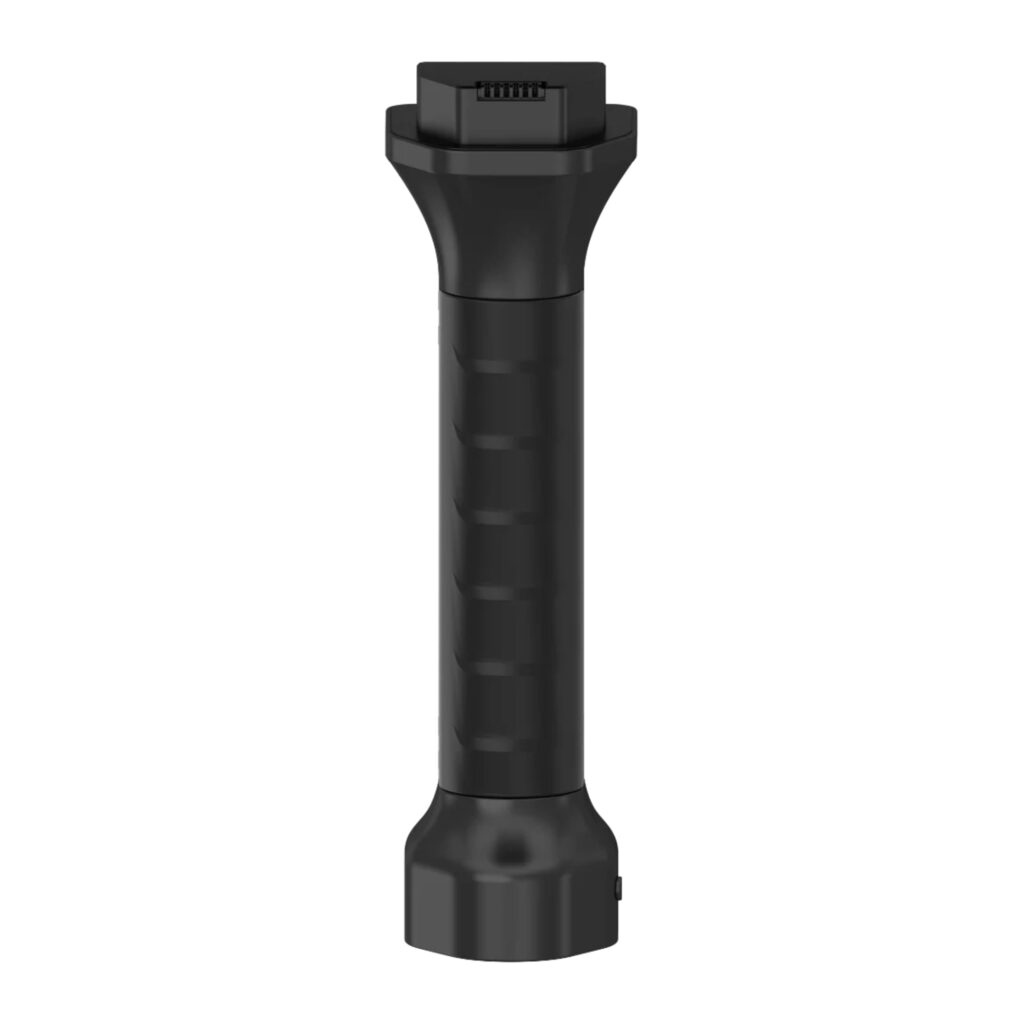
1 x Battery Handle
1 x Charger
1 x Calibration Plate
1 x Hard-Shell Case
1 x Magnetic Adapter
1 x USB-C Cable
1 x USB-C / USB-A SD / Micro-SD Card Reader
1 x SHARE Capture App
1 x SHARE PointClouds Studio Desktop Software
1 x Certificate of Conformity
1 x EU plug
SHARE Capture (iOS / Android)
SHARE PointClouds Studio (PC software)
BIM/CAD software workflows
Unreal Engine workflow integrations
SHARE3DCAM C1 Pro (S20 RTK)
Renovation Measurement
Can 3D scanning replace manual measurements during renovations?
For many renovation and interior documentation workflows, 3D scanning can replace most repetitive manual measurement work and make site capture faster, more complete, and easier to reuse. In practice, it is best viewed as a workflow improvement for renovation teams rather than a guarantee that every manual check can be eliminated on every project.
What is the best tool for measuring renovation projects?
Commonly used tools include tape measures, laser distance meters, and 3D scanners. Tape measures and laser distance meters are still suitable for simple checks. For complex spaces, repeated verification, modelling, drawing preparation, or coordination between multiple teams, 3D scanning is generally more practical because it captures more spatial context in a single workflow. Renovation measurements, 3D scanning
Can a 3D scanner replace manual on-site measurements?
For many indoor renovation projects, a 3D scanner can replace a large amount of repetitive manual measuring and note-taking. Critical dimensions, concealed spaces, installation details, and tolerance-sensitive checks may still require targeted manual verification. Manual measurements, Workflow limitations
Is 3D scanning suitable for renovating old buildings?
Yes. 3D scanning is often useful when renovating old buildings because the original drawings may be missing, incomplete, or different from the actual on-site conditions. A scan helps teams document the existing situation and create a more reliable reference point before design, measurement, or documentation begins. Old building renovation, Existing conditions
Interior Design
How can interior designers capture site dimensions more efficiently?
Interior designers can use 3D scanning to capture an entire space during a site visit. The point cloud or visual model can then be used as a reference during design preparation. This is especially useful for complex interiors, older buildings, and projects where faster quotation development is required. Interior design, Site dimensions
Can scan data improve communication with the client?
Scan data can help clients and project teams understand a space more clearly than photos or handwritten notes alone. Point clouds, visual representations, and measurable spatial data can support design discussions, quotation reviews, change communication, and coordination between designers, contractors, and clients.
Client communication, Spatial data
Do furniture and obstacles affect scan results?
They can. A scanner records visible conditions, so furniture, partitions, people, and clutter can cause local obstructions. Better route planning, capturing the space from multiple angles, and targeted verification can reduce their impact.
Obstruction, Capture path
Construction and As-Built Documentation
What is 3D scanning used for in construction documentation?
3D scanning can convert site conditions into verifiable and measurable spatial data. It is useful for documenting existing conditions, progress documentation, as-built documentation, coordination, and handover support.
Construction documentation, Site data
Can scan results support as-built documentation?
Yes. Scan results can support as-built documentation by providing a digital record of the actual site conditions. They can be used to verify measurements, compare progress, prepare drawings and handover documents, and discuss issues. However, final deliverables should still be checked against the applicable project standards.
As-built documentation, Handover documents
Point Clouds, CAD and BIM
What can point cloud data be used for?
Point cloud data can be used to verify measurements, assess spatial context, provide a reference for models, create CAD drawings, prepare BIM workflows, support coordination, and produce project documentation.
Point cloud, CAD
How is LiDAR scan data converted into CAD?
LiDAR scan data is usually processed into point clouds first. Software can then help generate or support CAD drawings. In practice, teams still need to review and edit the drawings according to drafting standards and project requirements.
DWG, Drawing output
Can scan data be used in CAD, SketchUp, or BIM workflows?
Yes. Scan data is often used as a reference for CAD drafting, SketchUp modelling, BIM preparation, measurement verification, and coordination. It should be viewed as a reliable spatial reference and workflow input rather than a fully automated replacement for professional drafting or modelling work.
CAD, BIM, SketchUp
Product Selection
How should teams choose a scanner for renovation and interior documentation?
Teams should evaluate workflow suitability rather than looking only at specifications. Practical factors include capture speed, ease of indoor use, output formats, software processing, team onboarding, and the requirements of later CAD, BIM, or documentation workflows.
Scanner selection, Workflow suitability
What are the SHARE SLAM S20 and S100 commonly used for?
The SHARE SLAM S20 is commonly used for handheld indoor capture, renovation measurements, interior spaces, and compact site documentation. The SHARE SLAM S100 is generally used for larger spaces, more complex sites, outdoor capture, mixed indoor and outdoor capture, and professional mobile mapping workflows.
SHARE SLAM S20, SHARE SLAM S100
Software Ecosystem
What do SHARE Capture and SHARE PointClouds Studio do?
SHARE Capture supports on-site capture, device connectivity, and fieldwork. SHARE PointClouds Studio supports point cloud processing workflows, data analysis, 3DGS model generation, CAD drawing preparation, and documentation.
If you’re a business located within the European Union (outside of the Netherlands), you may be eligible to purchase without VAT if you provide a valid EU VAT number.
How it works:
Enter your EU VAT number at checkout.
Our system will verify it automatically.
If the VAT number is valid, the VAT will be removed from your order total.
This option applies to both businesses outside and within the Netherlands, but a valid VAT number is required.
Stock and shipping information
We strive to keep you informed about the availability and shipping timelines for each product. Here’s how it works:
In Stock: This item is currently in stock and ready for dispatch. Stock may be located in one of our EU warehouses. All orders ship from a central EU location, so if the item is stored in a different EU warehouse, we will first transfer it to our central warehouse before shipping it directly to you. This may add a small delay, but our team prioritizes quick processing to minimize any wait time.
Available on Order: This item is not currently in stock, but we can order it for you. Once we place the order, it typically takes up to 3 weeks for the item to arrive at our central EU warehouse. From there, it will be shipped to you. Please note this extended timeline when planning your purchase.
Out of Stock: This item is currently unavailable for purchase. If you’re interested in obtaining this product, you can apply to join the Waitlist on the product page. By joining the Waitlist, you’ll receive an email notification as soon as the product is back in stock. Alternatively, feel free to contact us directly if you’d like more information about future availability.
If you have any questions or would like more detailed information about the availability or estimated arrival date for a specific item, please don’t hesitate to reach out to our support team.
SHARE3DCAM C1 Pro (S20 RTK) 3D LiDAR Scanner – 40m to 70m
Request a quote
We’ll get back to you within one business day.
By sending this quote request, you agree to our Privacy Policy.
SHARE3DCAM C1 Pro (S20 RTK) 3D LiDAR Scanner – 40m to 70m
Request Information
We’ll get back to you within one business day.
By sending this quote request, you agree to our Privacy Policy.
Request Information
We’ll get back to you within one business day.
By sending this quote request, you agree to our Privacy Policy.
We use cookies on our website to give you the most relevant experience by remembering your preferences and repeat visits. By clicking “Accept”, you consent to the use of ALL the cookies. However you may visit Cookie Settings to provide a controlled consent.
This website uses cookies to improve your experience while you navigate through the website. Out of these cookies, the cookies that are categorized as necessary are stored on your browser as they are essential for the working of basic functionalities of the website. We also use third-party cookies that help us analyze and understand how you use this website. These cookies will be stored in your browser only with your consent. You also have the option to opt-out of these cookies. But opting out of some of these cookies may have an effect on your browsing experience.
Cookie
Type
Duration
Description
__cf_bm
persistent
30 minutes
Cloudflare set the cookie to support Cloudflare Bot Management.
__kla_id
persistent
1 year 1 month 4 days
Klaviyo sets this cookie to collect information on the visitor’s behavior. This information is used for internal analytics and to optimise the website. It also registers if the visitor has subscribed to a news letter.
__kla_viewed
persistent
never
Klaviyo sets this cookie to collect information on the user's website navigation and preferences.
_drip_client_*
persistent
1 year 1 month 4 days
Drip sets this cookie to track user behaviour on a website and to collect information about the user's preferences and interests.
_ga
persistent
1 year 1 month 4 days
Google Analytics sets this cookie to calculate visitor, session and campaign data and track site usage for the site's analytics report. The cookie stores information anonymously and assigns a randomly generated number to recognise unique visitors.
_ga
1 year 1 month 4 days
Google Analytics sets this cookie to calculate visitor, session and campaign data and track site usage for the site's analytics report. The cookie stores information anonymously and assigns a randomly generated number to recognise unique visitors.
_ga_*
persistent
1 year 1 month 4 days
Google Analytics sets this cookie to store and count page views.
_ga_*
1 year 1 month 4 days
Google Analytics sets this cookie to store and count page views.
_gat
persistent
1 minute
Google Universal Analytics sets this cookie to restrain request rate and thus limit data collection on high-traffic sites.
_gat_UA-*
persistent
1 minute
Google Analytics sets this cookie for user behaviour tracking.
_gcl_au
persistent
3 months
Google Tag Manager sets the cookie to experiment advertisement efficiency of websites using their services.
_gid
persistent
1 day
Google Analytics sets this cookie to store information on how visitors use a website while also creating an analytics report of the website's performance. Some of the collected data includes the number of visitors, their source, and the pages they visit anonymously.
_sn_a
persistent
1 year
SleekNote sets this cookie to measure visitor analytics. in order to identify the visitor across sessions, a visitor ID is set.
_sn_m
persistent
1 year
SleekNote sets this cookie to record information used for marketing-related targeting options.
_sn_n
persistent
1 year
SleekNote sets this cookie to ensure that the user only gets the Sleeknote popup on the first visit.
_uetsid
persistent
1 day
Bing Ads sets this cookie to engage with a user that has previously visited the website.
_uetvid
persistent
1 year 24 days
Bing Ads sets this cookie to engage with a user that has previously visited the website.
CONSENT
persistent
2 years
YouTube sets this cookie via embedded YouTube videos and registers anonymous statistical data.
cookielawinfo-checkbox-advertisement
persistent
1 year
Set by the GDPR Cookie Consent plugin, this cookie records the user consent for the cookies in the "Advertisement" category.
cookielawinfo-checkbox-analytics
persistent
11 months
This cookie is set by GDPR Cookie Consent plugin. The cookie is used to store the user consent for the cookies in the category "Analytics".
cookielawinfo-checkbox-functional
persistent
11 months
The cookie is set by GDPR cookie consent to record the user consent for the cookies in the category "Functional".
cookielawinfo-checkbox-necessary
persistent
11 months
This cookie is set by GDPR Cookie Consent plugin. The cookies is used to store the user consent for the cookies in the category "Necessary".
cookielawinfo-checkbox-others
persistent
11 months
This cookie is set by GDPR Cookie Consent plugin. The cookie is used to store the user consent for the cookies in the category "Other.
cookielawinfo-checkbox-performance
persistent
11 months
This cookie is set by GDPR Cookie Consent plugin. The cookie is used to store the user consent for the cookies in the category "Performance".
CookieLawInfoConsent
persistent
1 year
CookieYes sets this cookie to record the default button state of the corresponding category and the status of CCPA. It works only in coordination with the primary cookie.
CookieLawInfoConsent
1 year
CookieYes sets this cookie to record the default button state of the corresponding category and the status of CCPA. It works only in coordination with the primary cookie.
elementor
persistent
never
The website's WordPress theme uses this cookie. It allows the website owner to implement or change the website's content in real-time.
elementor
never
The website's WordPress theme uses this cookie. It allows the website owner to implement or change the website's content in real-time.
IDE
persistent
1 year 24 days
Google DoubleClick IDE cookies store information about how the user uses the website to present them with relevant ads according to the user profile.
MUID
persistent
1 year 24 days
Bing sets this cookie to recognise unique web browsers visiting Microsoft sites. This cookie is used for advertising, site analytics, and other operations.
SNS
persistent
session
This is an analytic cookie used to collect information like how the website is being used and to check how effective the marketing campaigns are.
test_cookie
persistent
15 minutes
doubleclick.net sets this cookie to determine if the user's browser supports cookies.
viewed_cookie_policy
persistent
11 months
The cookie is set by the GDPR Cookie Consent plugin and is used to store whether or not user has consented to the use of cookies. It does not store any personal data.
viewed_cookie_policy
1 year
The GDPR Cookie Consent plugin sets the cookie to store whether or not the user has consented to use cookies. It does not store any personal data.
VISITOR_INFO1_LIVE
persistent
5 months 27 days
YouTube sets this cookie to measure bandwidth, determining whether the user gets the new or old player interface.
wp-wpml_current_language
persistent
session
WordPress multilingual plugin sets this cookie to store the current language/language settings.
YSC
persistent
session
Youtube sets this cookie to track the views of embedded videos on Youtube pages.
yt-remote-connected-devices
persistent
never
YouTube sets this cookie to store the user's video preferences using embedded YouTube videos.
yt-remote-device-id
persistent
never
YouTube sets this cookie to store the user's video preferences using embedded YouTube videos.
yt.innertube::nextId
persistent
never
YouTube sets this cookie to register a unique ID to store data on what videos from YouTube the user has seen.
yt.innertube::requests
persistent
never
YouTube sets this cookie to register a unique ID to store data on what videos from YouTube the user has seen.
Analytical cookies are used to understand how visitors interact with the website. These cookies help provide information on metrics the number of visitors, bounce rate, traffic source, etc.
Cookie
Duration
Description
__kla_id
1 year 1 month 4 days
Klaviyo sets this cookie to collect information on the visitor’s behavior. This information is used for internal analytics and to optimise the website. It also registers if the visitor has subscribed to a news letter.
_drip_client_*
1 year 1 month 4 days
Drip sets this cookie to track user behaviour on a website and to collect information about the user's preferences and interests.
_ga
1 year 1 month 4 days
Google Analytics sets this cookie to calculate visitor, session and campaign data and track site usage for the site's analytics report. The cookie stores information anonymously and assigns a randomly generated number to recognise unique visitors.
_ga
1 year 1 month 4 days
Google Analytics sets this cookie to calculate visitor, session and campaign data and track site usage for the site's analytics report. The cookie stores information anonymously and assigns a randomly generated number to recognise unique visitors.
_ga_*
1 year 1 month 4 days
Google Analytics sets this cookie to store and count page views.
_ga_*
1 year 1 month 4 days
Google Analytics sets this cookie to store and count page views.
_gat
1 minute
Google Universal Analytics sets this cookie to restrain request rate and thus limit data collection on high-traffic sites.
_gat_UA-*
1 minute
Google Analytics sets this cookie for user behaviour tracking.
_gcl_au
3 months
Google Tag Manager sets the cookie to experiment advertisement efficiency of websites using their services.
_gid
1 day
Google Analytics sets this cookie to store information on how visitors use a website while also creating an analytics report of the website's performance. Some of the collected data includes the number of visitors, their source, and the pages they visit anonymously.
_sn_a
1 year
SleekNote sets this cookie to measure visitor analytics. in order to identify the visitor across sessions, a visitor ID is set.
CONSENT
2 years
YouTube sets this cookie via embedded YouTube videos and registers anonymous statistical data.
SNS
session
This is an analytic cookie used to collect information like how the website is being used and to check how effective the marketing campaigns are.
Necessary cookies are absolutely essential for the website to function properly. These cookies ensure basic functionalities and security features of the website, anonymously.
Cookie
Duration
Description
cookielawinfo-checkbox-analytics
11 months
This cookie is set by GDPR Cookie Consent plugin. The cookie is used to store the user consent for the cookies in the category "Analytics".
cookielawinfo-checkbox-functional
11 months
The cookie is set by GDPR cookie consent to record the user consent for the cookies in the category "Functional".
cookielawinfo-checkbox-necessary
11 months
This cookie is set by GDPR Cookie Consent plugin. The cookies is used to store the user consent for the cookies in the category "Necessary".
cookielawinfo-checkbox-others
11 months
This cookie is set by GDPR Cookie Consent plugin. The cookie is used to store the user consent for the cookies in the category "Other.
cookielawinfo-checkbox-performance
11 months
This cookie is set by GDPR Cookie Consent plugin. The cookie is used to store the user consent for the cookies in the category "Performance".
CookieLawInfoConsent
1 year
CookieYes sets this cookie to record the default button state of the corresponding category and the status of CCPA. It works only in coordination with the primary cookie.
elementor
never
The website's WordPress theme uses this cookie. It allows the website owner to implement or change the website's content in real-time.
viewed_cookie_policy
1 year
The GDPR Cookie Consent plugin sets the cookie to store whether or not the user has consented to use cookies. It does not store any personal data.
viewed_cookie_policy
11 months
The cookie is set by the GDPR Cookie Consent plugin and is used to store whether or not user has consented to the use of cookies. It does not store any personal data.
Functionele cookies helpen bij het uitvoeren van bepaalde functionaliteiten, zoals het delen van de inhoud van de website op sociale mediaplatforms, het verzamelen van feedback en andere functies van derden.
Cookie
Duration
Description
__cf_bm
30 minutes
Cloudflare set the cookie to support Cloudflare Bot Management.
_sn_n
1 year
SleekNote sets this cookie to ensure that the user only gets the Sleeknote popup on the first visit.
wp-wpml_current_language
session
WordPress multilingual plugin sets this cookie to store the current language/language settings.
Advertentiecookies worden gebruikt om bezoekers relevante advertenties en marketingcampagnes aan te bieden. Deze cookies volgen bezoekers over websites heen en verzamelen informatie om aangepaste advertenties te kunnen tonen.



 English
  Nederlands
 Français
 Deutsch
 Español
 Italiano



